Trail Maps
-
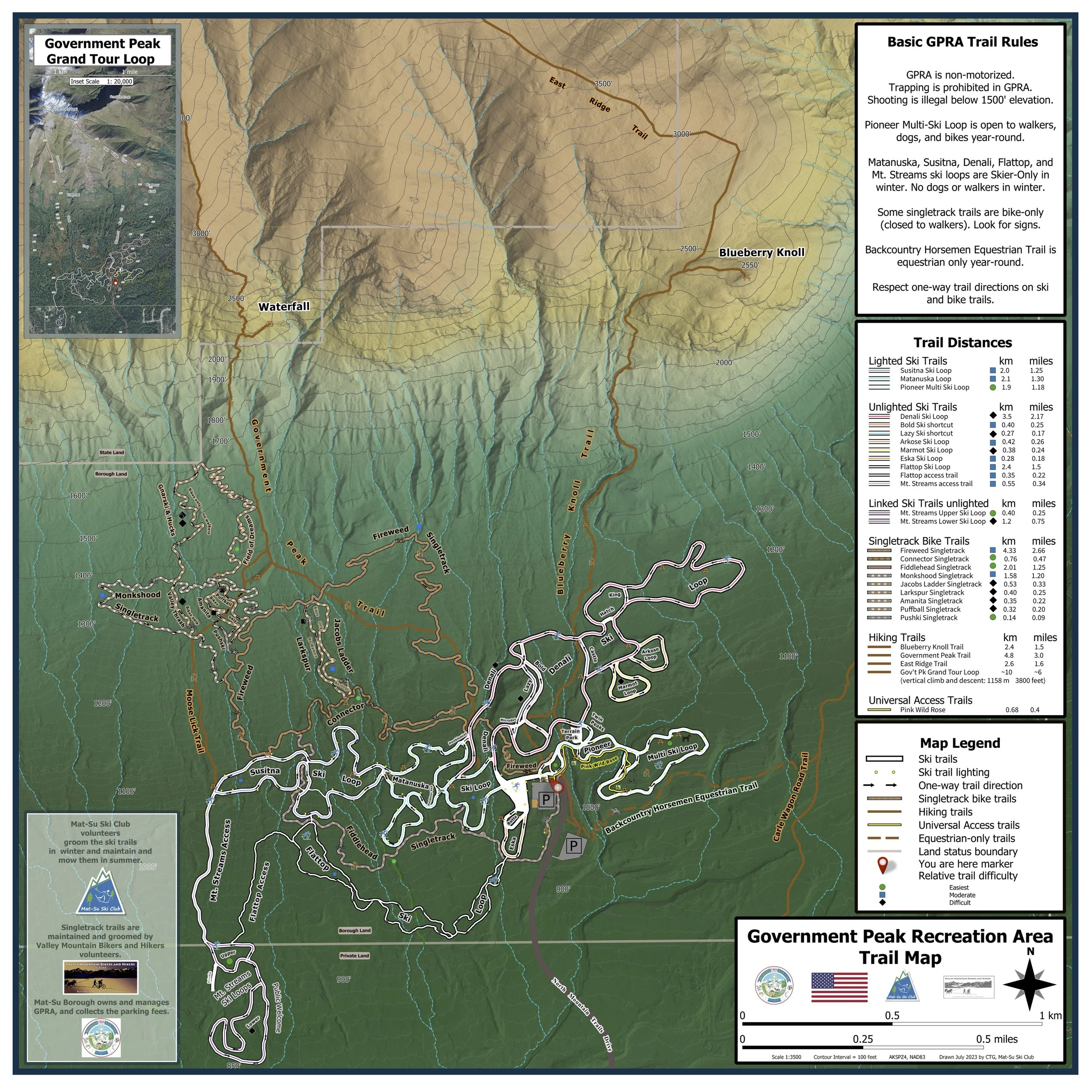
Government Peak Recreation Area Trail Map
-

Moose Range Trail Map
-

Archangel Road Map
geopdf maps can be used in location mapping apps such as Avenza or Gaia
GPRA
10690 N. Mountain Trails Dr., Palmer, AK
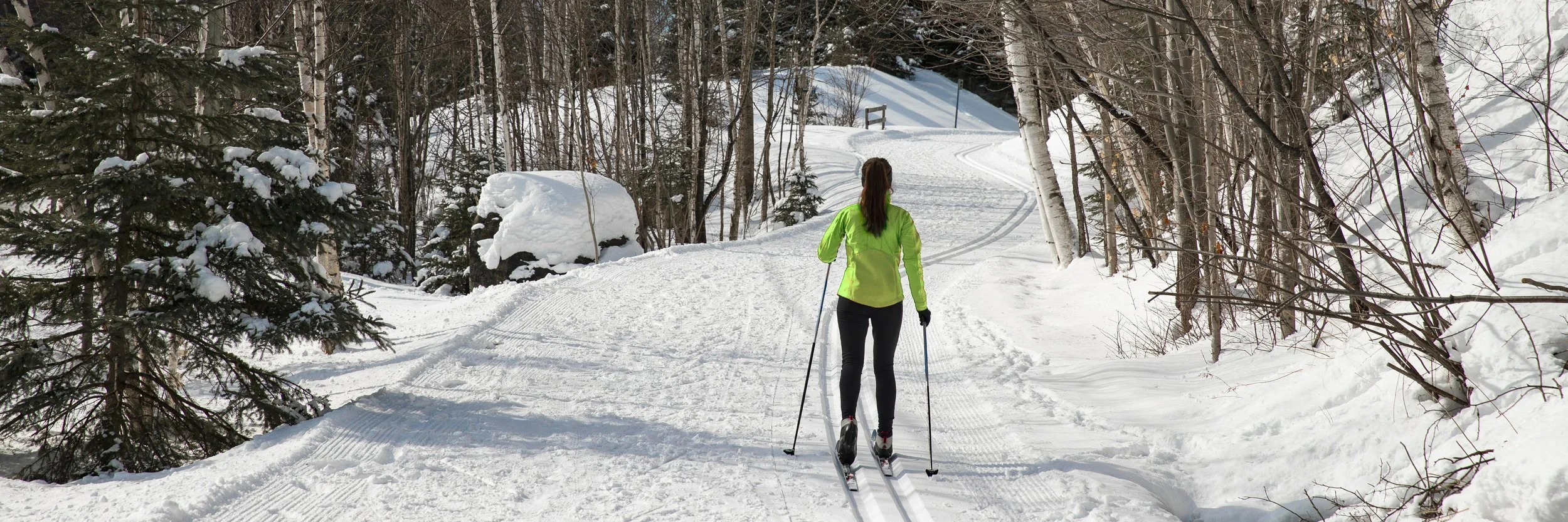
The Mat-Su Ski Club maintains 17 km of groomed Nordic ski trails, with 6.5 km lighted in the evenings. GPRA opens at 8 AM and closes at 10 PM (summer), 9 PM (winter)
What is GPRA?
Government Peak Recreation Area is located on the southern flank of Government Peak, within the community of Fishhook and near the towns of Palmer and Wasilla, GPRA is a 1420 acre (2.22 square miles) parcel of Mat-Su Borough-owned land within the State of Alaska’s Hatcher Pass Management Area. GPRA is bounded on the west, east, and north by undeveloped public land. Private residential land lies south of GPRA. Long-term Mat-Su Borough plans for GPRA include amphitheaters, additional parking, a disc golf course, a biathlon facility, and continued development of mountain bike trails, cross-country ski trails, multi-use trails, hiking trails, and equestrian trails. The map to the left shows only the part of GPRA with developed cross-country ski and singletrack (bike) trails. The Castle Mt. Fault is an interesting geological feature that cuts through GPRA. Similar to the San Andreas or Denali Faults, it is thought to be capable of large earthquakes. Over time, the north (mountain) side of the fault has risen a mile or more. Cliffs of broken and twisted rocks are exposed nearby in a roadside landslide where the Little Su River cuts a canyon through the fault trace.
Government Planning Documents Concerning GPRA
Trailheads Location Map
GPRA - Driving directions
Drive towards Hatcher Pass on the Palmer-Fishhook Road or the Wasilla Fishhook Road.
Turn left onto Edgerton Parks Road 3/4 mile after Turners yellow store.
Turn right after 1 mile onto N. Mt. Trails Dr. to GPRA.
Moose Range - Driving directions to Wendt Road trailhead
Take Trunk Road, or drive through Palmer, to get to the Palmer-Fishhook Road.
Drive north on the Palmer-Fishhook Road towards Hatcher Pass.
Keep going until you see Turners store. Slow down and turn right onto Sun Valley Dr. before the store. Drive slowly through the neighborhood, around the curve, then turn right onto Wendt. Drive to end of road.
Independence Mine/Archangel Road - Driving directions
Drive towards Hatcher Pass on the Palmer-Fishhook Road or the Wasilla Fishhook Road.
Follow posted signs for Hatcher Pass
Archangel Road Access
Drive to approximately Mile 14.4 on Hatcher Pass Road
Winter parking is located across Hatcher Pass Road from the Archangel trail entrance
Independence Mine Access
Continue driving about 3 miles past Archangel Road to the end of Hatcher Pass Road
Ample winter parking is available at the Independence Mine trailhead
Winter Note: Road conditions can change quickly. Check current conditions and plan accordingly before heading up.
Mud Lake (Knik River Public Use Area) – Driving Directions
From Palmer, follow the Old Glenn Highway east for approximately 3.5 miles.
Turn left onto Maud Road and continue for about 3 miles as the road narrows.
Look for the parking area on the right, which provides access to Mud Lake.Parking Note: Please park efficiently and be mindful of other trail users.